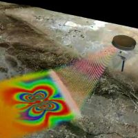
 In Science, Julia Rosen (@1JuliaRosen) shows us how a technique called interferometric synthetic aperture radar, or InSAR, can use satellite data to detect movements of just a few millimeters across a wide swath of the earth’s crust. Rosen takes us on a tour of this methodology, which has a range of applications from water management to transportation, and gives us a window into its power for helping humanity. Image: NASA
